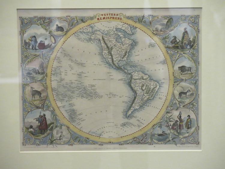
Hand-coloured engraved map entitled 'WESTERN HEMISPHERE', showing the earth from the Solomon Islands and New Zealad to the Azores and Cape Verde Islands, and the Arctic to Antarctica, in a circular projection. The main features are the Pacific Ocean and the Americas. On either side of the map is an ornate border with a series of roughly circular scenes of various size set amongst tendrils.
On the left, top to bottom: a walrus; three Inuit and a dog; a ringtailed animal, possibly a racoon or lemur; a llama; three people, possibly Maori; a penguin.
On the right, top to bottom: a polar bear; three Native Americans; a bison; a big cat; a standing European man in 16th- or 17th-century dress and a standing and a sitting person, possibly intended to be native South Americans; two whales.