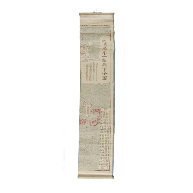
Hanging scroll map, first in a set of eight. Entitled: "Da Qing wan nian yi tong tian xia quan tu" which translates literally as 'Great Qing ten thousand years unified the country complete picture'. The map shows Korea and Japan beyond the eastern border of China. The colophone at the bottom right was recorded by Zhu Xi-ling in the Jiaqing period (1796-1820) of the Qing dynasty. Woodblock print, ink on paper.